Poziomice combine points on the map of the same amount. On many maps along each spirit level there is a corresponding height above sea level. The numbers meaning this height are written in accordance with the decrease in the slope.
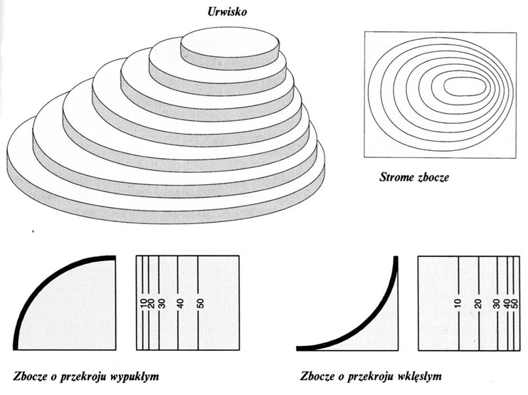
Cliff – When trying to read from the map, the form should be paid to the intervals between the levels and height, which the individual levels correspond to. It can happen, that rarely deleted levels do not include several-meter cliffs of steep walls located between the neighboring lines separated by a wide interval.
Steep slope – Gradually, the narrowing spacing between the levels on the map speak of the existence of a slope. Poziysomice located close to each other means a very steep slope.
The slope with a convex cross -section – Standing at the foot of the slope with a convex cross -section, you can't see its top. It is steep at the foot, and milder at the top; This is shown on the map by the gradually increasing spacing between the levels.
A slope with a concave cross -section – Standing at the foot of the slope with a concave section, you can see its top. The slope of such a slope increases with the height. On the map you can get to know this by narrowing intervals between the levels.
 Poziysomice on the map


