The situation is almost impossible, in which we do not know, where we are. Even the surviving victims of the air disaster know at least what country or the surrounding area they flew. Determining the position is therefore the gradual narrowing of the likely stay, until you find a specific point on the map and eliminate others. If you can enter, For example, on the radio, Coordinates of the place, where you are, you will make it easier for the rescue team to be searching. If you know, on what map to look for a place, in which you are, You shouldn't be careful, that you got lost. Referring characteristic landscape points, which you see, to marked on the map, You will quickly locate your location. In this case, the method of gradually narrowing the alleged residence turns out to be very effective. Sometimes you have to make your own map, for example, if you do not have a map of a given area or this, which you have, it is too little detailed.
Finding your position on the map
When determining the place, in which you are, You must refer your position to the characteristic elements of the landscape and find their symbols on the map. Azimuth should be determined using the compass, that is, the angle between the north and direction, at which the characteristic landscape point is. After tracking and determining their azimuths, two lines on the map can be carried out, which, when cutting, will determine the position of the observer.
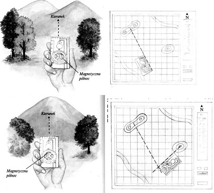
1 Drive the compass to some characteristic landscape point, For example, a pass. Turn the compass disc, when the north indicating the north on the shield will indicate the same direction, what a magnetic needle. In this way you will appoint azimuth.
2 Put the compass on the map, on the symbol marking the pass and move it until, When the arrow on the shield shows north on the map. Draw a line connecting the pass with the place, to which you moved the compass. Its direction is determined by the previously measured azimuth.
3 Direct the compass to another, A clearly visible landscape point. It should be at an angle of about 90 ° to the previous one and at least one kilometer away from the observer. The vertices of hills are excellent landmarks.
4 Draw a line on the map coming out of the symbol meaning the top of the hill, According to the method described above. Your position is determined by the intersection of both lines. You can delete the third line, The measurement will be more accurate.


