The coordinates allow you to accurately determine the location of the point on the map. This is enabled by a cartographic or topographic mesh of vertical and horizontal lines corresponding to meridians and parallels. When determining the position, the vertical coordinate is always given first. Some parts of the map can be additionally marked with letters. To accurately determine the location of the point on the topographic map, You should find the nearest vertical line and read the corresponding coordinate written at the bottom of the map (In our example 04). Then estimate, How many tenths are our point from this line (in this case 5). The horizontal coordinate is determined in the same way. (In this case it is easy, because the point lies on the topographic mesh line with coordinate 41).
Determining the exact location – The above method allows you to accurately determine the location of the point on the map using a six -digit record (045410), in which the first three numbers mean vertical coordinate, and the next three – horizontal.
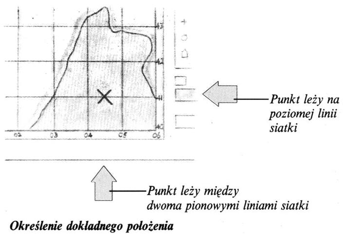 The coordinates allow you to accurately determine the location of the point on the map. This is enabled by a cartographic or topographic mesh of vertical and horizontal lines corresponding to meridians and parallels. When determining the position, the vertical coordinate is always given first. Some parts of the map can be additionally marked with letters. To accurately determine the location of the point on the topographic map, You should find the nearest vertical line and read the corresponding coordinate written at the bottom of the map (In our example 04). Then estimate, How many tenths are our point from this line (in this case 5). The horizontal coordinate is determined in the same way. (In this case it is easy, because the point lies on the topographic mesh line with coordinate 41).


