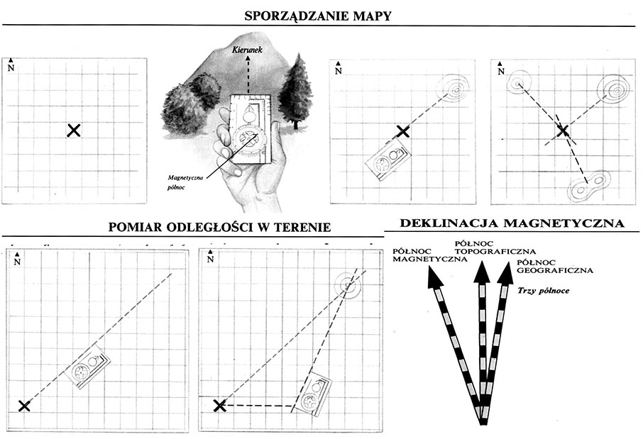
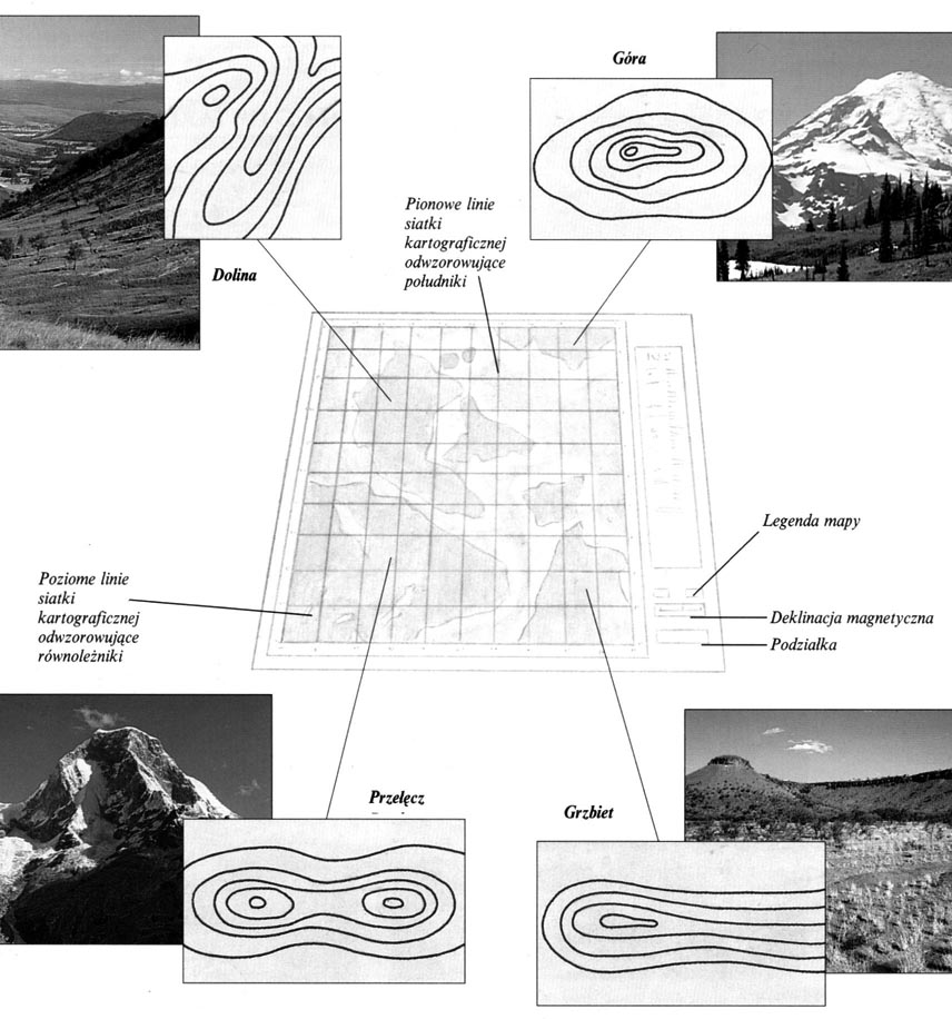
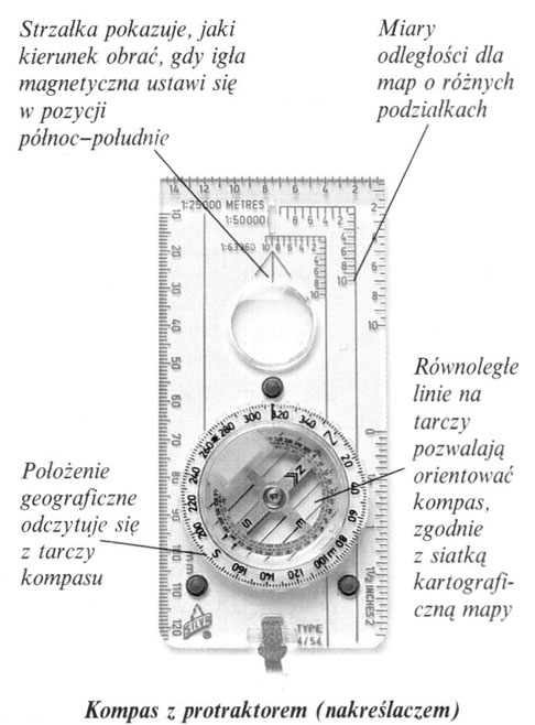
Orientation in the field

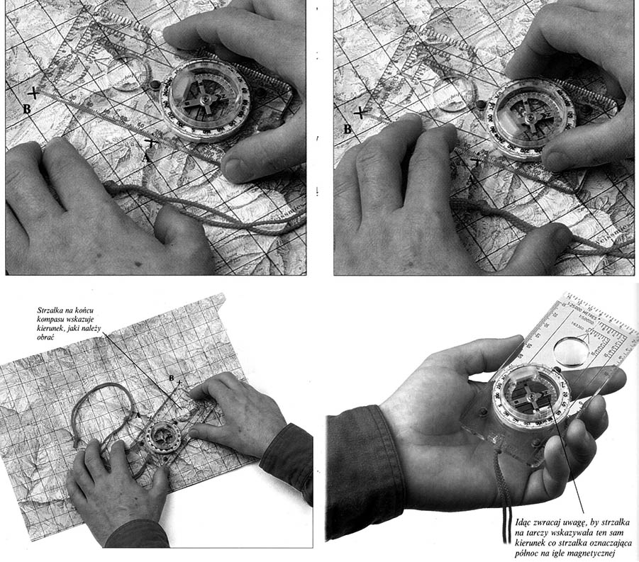
The orientation in the field requires, above all, the ability to use the map and compass. They are used to set out the shortest, and at the same time the safest road in a diverse area. On land it is impossible to determine the roads so precisely, as at sea. There you can set a simple course, …

MAP Preparation

MAP Preparation

1 On a piece of paper, remove a rectangular mesh with mesh corresponding to one square kilometer of the area of ​​the area. In the middle, draw a cross meaning your position.

2 Find a convenient observation point. Designate azimuth compass, determining the direction of a characteristic point on the horizon. Oszacuj odległość …

Using GPS – em

Using GPS – em

GPS, So Global Positioning has radically changed the methods of maritime and air navigation and ways to determine the location in the field. The system uses artificial satellites circulating in the Earth's orbit, which send radio signals to the ground. Posługując się specjalnym …

Determining the position according to the map

The situation is almost impossible, in which we do not know, where we are. Even the surviving victims of the air disaster know at least what country or the surrounding area they flew. Determining the position is therefore the gradual narrowing of the likely stay, aż do odnalezienia konkretnego punktu na mapie …

Cartographic mapping

The map is to present as accurately as possible on the plane a selected segment of the convex surface of the earth. Any projection of the globe on the flat surface of the cylinder or cone must deform the image of the earth in one way or another. Dlatego też mapy nigdy wiernie nie oddają wszystkich cech …

Coordinates on the map

Coordinates on the map

The coordinates allow you to accurately determine the location of the point on the map. This is enabled by a cartographic or topographic mesh of vertical and horizontal lines corresponding to meridians and parallels. When determining the position, the vertical coordinate is always given first. Niektóre części mapy mogą …

Levels

Poziysomice on the map

Poziomice combine points on the map of the same amount. On many maps along each spirit level there is a corresponding height above sea level. The numbers meaning this height are written in accordance with the decrease in the slope.

Cliff – Starając się odczytać …

Reading the map

There are many types of maps for various purposes available. The right choice is of great importance for the prepared trip. You should often take a few maps, among which there should be one with a small pitch (scale), depicting the entire area of ​​the journey, and a few more accurate, individual areas. …

Compass – Determining the directions of the world

Compass – Determining the directions of the world

The ability to determine the directions of the world is the basis of good orientation in the field. Therefore, the compass is the most important device, who takes his way. A watch is also necessary, which also allows you to mark the direction, as well as estimating the distance traveled, …